(1)")

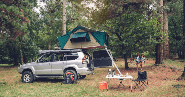
Although stand-alone overlanding navigation devices, like the Garmin Overland, can be very helpful, they’re also very expensive.
As a beginner, you might not be ready to spend the big bucks on a specialized off-road GPS, but don’t worry, there’s an alternative, the Gaia GPS Application.
Could this be the best overlanding navigation app? let’s find out!
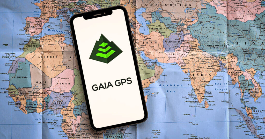
About

Gaia GPS specializes in outdoor navigation and offers navigation and tracking solutions for not only overlanding, but also hiking, mountain biking; backcountry skiing, and much more.
The application was originally launched in 2009 by TrailBehind Inc. and is available on IOS and Android.
Cost
There’s a free version of the app available. Additionally, you can subscribe to Gaia Premium.
This will set you back $39,99 USD/year, but you’ll be able to access the entire Map Catalog. You’ll also be able to download your favorite maps for offline use, print maps for physical back-ups, and layer maps on top of each other. This way you can get all the information you need all together on one screen, without having to switch between different maps.
If you want to try Gaia Premium out before committing to a full-year subscription, you can do so by signing up for the free 7-day trial Gaia offers.
Maps
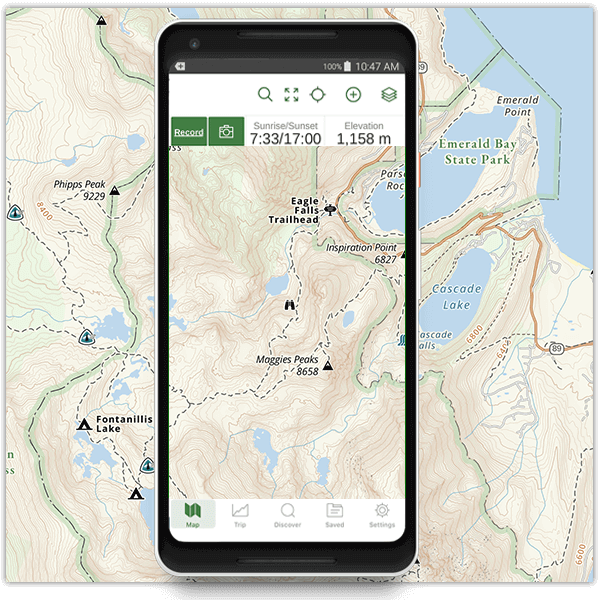
Gaia GPS doesn’t only offer topographic and satellite maps.
There are over 300 different map layers available for use. These can vary from maps showing the weather forecast for a region to maps displaying where you’ll have cell coverage; where you can see whether you’re on private land; how deep the snow is or even where there are currently wildfires going on.
However, there are three important things to note when it comes to Gaia’s maps:
- You’ll need to be a Gaia Premium Member to not only be able to layer maps on top of each other but also to gain access to basically any layer other than the standard global topographic map which comes with the free version.
- Even if you’re a premium member, some of the maps will only show accurate information for the US and Canada (e.g. weather forecast and cell coverage).
- Some of the maps may require an internet connection to be able to get updates and therefore give you accurate live information.
Offline
Gaia Premium is needed to download maps so you can access them offline.
Coverage
Gaia GPS has global coverage. There are many map layers to get more detailed information for a specific country or region.
As we already discussed above, the focus point of the specialized maps and features lies in the US and Canada. If you are interested in a specific specialty layer Gaia offers but are located outside of North America, it’s recommended to use the 7-day free trial to find out whether your desired region or country is covered by that map or not.
Tracking
Gaia GPS also allows you to track your voyage. You can customize the interface to show your speed; ETA; elevation; local weather; sunset & sunrise times for your location; and much more.
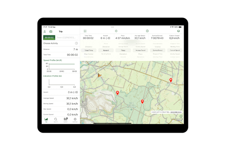
After your journey, you can access this data, and if you choose to, share your route with other Gaia users.
Planning
While this might not be necessary for overlanders who just want to get out there and see where the day takes them, some overlanders like some more control over their route.
Gaia GPS allows you to plan your route. Features like the ‘clip to road’ make it easier to quickly navigate from one waypoint to another, but you might miss out on some dirt road gems this way.
You can add waypoints, view nearby POIs1, and draw routes on the map. You can even access other users’ routes if they’ve been published publicly.
If you have already made a route before using Gaia, or you have downloaded an external route, you can simply load the GPX files into the app and get started.
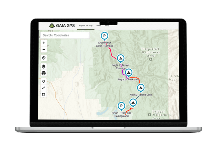
There’s also a web version of Gaia available. The bigger screen can make planning a bit easier. The Gaia Cloud easily syncs your routes to all your other devices.
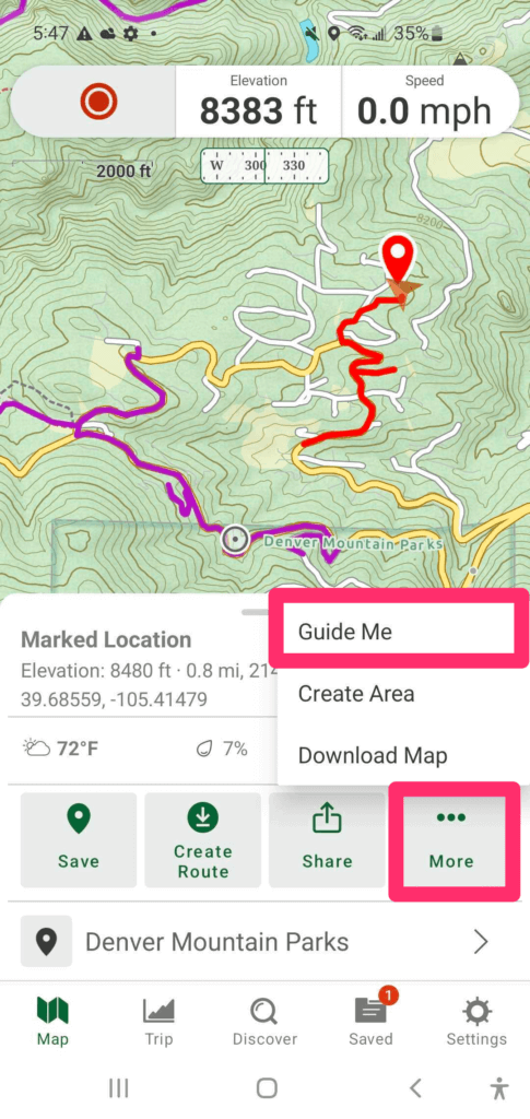
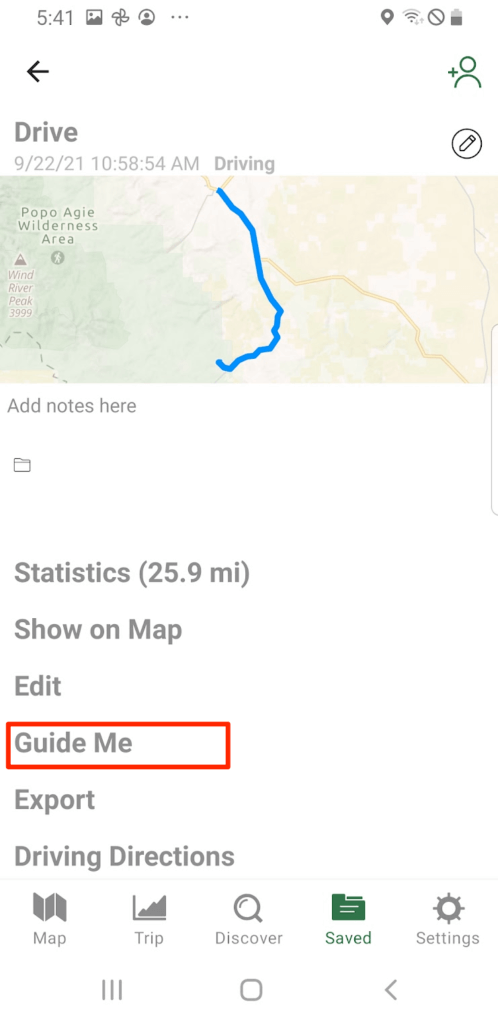
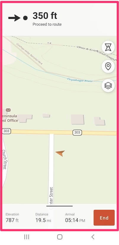
Navigation
Gaia GPS offers “turn-to-turn” navigation. This is probably the biggest advantage of using the app, and exactly where other off-road GPS apps fall flat. While you’re driving, it’s not safe to be messing around with a map on your phone.
Besides, your phone screen probably won’t be big enough to comfortably read the maps yourself. So, turn-to-turn safety is not just a nice plus, it’s a must.
Here’s how to start the turn-to-turn navigation:
Conclusion
Gaia’s map layers are numerous and diverse. However, the functionality of these layers is mainly restricted to US & Canadian users.
We would suggest Gaia’s team consider expanding the reach and functionality of these layers. This way overlanders from all over the world could weep the full benefits of the Gaia App.
The app might take a bit of getting used to if you’re a beginner, but overall the app’s tracking interface & route planner are beginner-friendly. It did take us some time to figure out how to turn on the “turn-to-turn” navigation since it takes a couple of clicks to get there.
Ideally, the process could be made a bit more straightforward, by just having the ‘guide me’ button appear directly on the map.

The map and interface might be a bit small on your mobile phone. If you want a more stand-alone GPS feel, safely securing your tablet in your vehicle and having the app on there can make the navigation process more comfortable, especially during longer trips.
If you want to get the full experience, you’ll need a Gaia premium subscription, but the free version and free 7-day trial will allow you to get a feel for the app and see whether Gaia GPS is for you.
While Gaia GPS isn’t exclusively made for off-road driving and overlanding, it can still be very useful for it. The customization lets you specify the app to your overlanding needs, and you can track and plan your routes.
We highly recommend the “Gaia overland layer” (only available via Gaia Premium). This map layer is explicitly made for overlanding and shows backroads, dirt roads, and other information that might be useful to overlanders.
Want to give it a try? Download the app here!